Location and geographical importance
Zojila Pass Avalanche and Strategic Himalayan Connectivity: Zojila Pass is a high-altitude mountain pass located in the Kargil district of Ladakh. It lies on the Srinagar–Kargil–Leh highway (NH-1) at an elevation of around 11,650 feet. The pass forms a crucial link between the Kashmir Valley and Ladakh region.
Due to extreme snowfall and harsh winters, the pass remains closed for nearly six months every year. This seasonal closure significantly impacts civilian travel and supply routes.
Static GK fact: Zojila Pass is part of the Greater Himalayan Range, one of the youngest and most unstable mountain ranges in the world.
Strategic importance in defence
Zojila Pass holds immense importance for maintaining connectivity to India’s border areas. It serves as a lifeline for transporting defence equipment and essential supplies to forward posts in Ladakh.
Historically, the pass played a key role during the Indo-Pakistan War of 1947–48. Under Operation Bison, Indian forces successfully recaptured the pass on 1 November 1948, marking a milestone in high-altitude warfare.
Static GK Tip: Operation Bison is one of the earliest examples of tank warfare conducted at high altitudes in the world.
Avalanche and its causes
An avalanche refers to the sudden and rapid movement of snow down a slope. It is commonly triggered by unstable snow layers, steep slopes, and continuous snowfall.
Regions like Zojila are highly prone to avalanches due to lack of vegetation and frequent snow accumulation. Weak bonding between snow layers increases the risk of sudden collapse.
Static GK fact: Avalanches are more common in slopes ranging between 30° to 45°, where gravitational force easily overcomes snow stability.
Impact on connectivity and safety
The recent avalanche at Zojila Pass has disrupted movement along the NH-1 corridor, affecting both civilian transport and military logistics. It highlights the vulnerability of Himalayan routes to extreme weather conditions.
Frequent avalanches pose risks to travellers, infrastructure, and defence supply chains. This makes continuous monitoring and weather forecasting essential for safety.
Way forward and infrastructure development
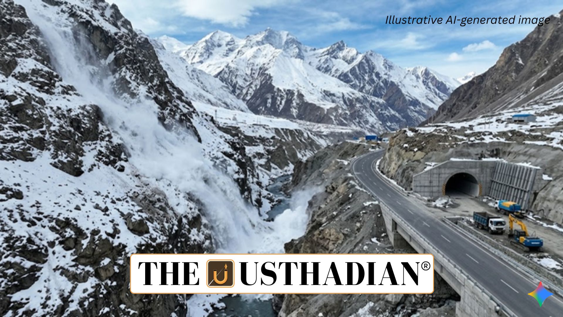
To ensure all-weather connectivity, India is developing the Zojila Tunnel, which will bypass the snow-prone pass. This tunnel aims to provide uninterrupted connectivity between Srinagar and Leh throughout the year.
Improving avalanche prediction systems, strengthening road infrastructure, and deploying rescue teams are crucial for reducing risks. Technological solutions like remote sensing and satellite monitoring can enhance preparedness.
Static GK Tip: The Zojila Tunnel, once completed, will be one of Asia’s longest bi-directional road tunnels.
Static Usthadian Current Affairs Table
Zojila Pass Avalanche and Strategic Himalayan Connectivity:
| Topic | Detail |
| Location | Zojila Pass in Kargil district, Ladakh |
| Altitude | Approximately 11,650 feet |
| Highway | NH-1 connecting Srinagar, Kargil, Leh |
| Strategic Role | Vital for defence logistics and connectivity |
| Historical Event | Operation Bison in 1948 |
| Avalanche Cause | Weak snow layers and heavy snowfall |
| Key Challenge | Seasonal closure due to extreme weather |
| Infrastructure Project | Zojila Tunnel for all-weather connectivity |