River that shapes the Northeast
China’s Dams and the Brahmaputra Debate: The Brahmaputra River plays a central role in shaping the lives and economy of northeastern India. Originating in Tibet as the Yarlung Tsangpo, it flows into Arunachal Pradesh as the Siang and then travels through Assam, where it becomes a wide and powerful river. It later enters Bangladesh as the Jamuna, forming a crucial part of the regional water system.
In recent discussions, Assam’s Chief Minister Himanta Biswa Sarma remarked that most of the water in the Brahmaputra is sourced within India. This perspective comes amid rising concerns about China’s upstream dam constructions, including the massive Medog Hydropower Project.
The dam projects in Tibet
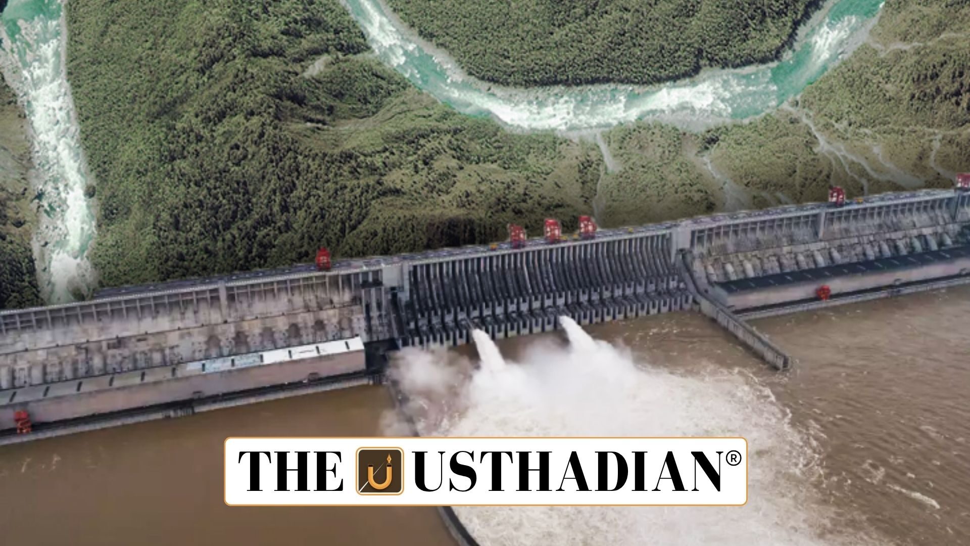
China’s plans to build several dams on the upper stretches of the Brahmaputra in Tibet have raised concerns in India. The Medog project, which is set to become the largest hydropower facility in the world, is being designed mainly for generating electricity, not storing water.
That makes a big difference. Unlike storage dams, run-of-the-river projects like these generally don’t hold back much water. Yet, India remains watchful. Even temporary diversions or changes in flow during non-monsoon seasons could affect local hydropower output and river health.
Where the water actually comes from?
Interestingly, while only about 34% of the Brahmaputra basin lies in India, the country contributes over 80% of the water flow. Why? Because India receives heavy rainfall, especially in the Northeast. With an annual average of 2,371 mm, India’s segment of the basin is naturally rich in water.
The monsoon adds further strength to this flow. Most of the water from Assam and Arunachal Pradesh’s many tributaries feeds into the Brahmaputra, making the river extremely dynamic and flood-prone.
Less water from China, less flood?
It may sound counterintuitive, but some experts believe that reduced water flow from China might help mitigate annual floods in Assam. Every year, the state faces widespread damage due to overflowing rivers. So, smaller volumes from upstream might ease the pressure.
However, this doesn’t mean India can ignore the risks. Sudden releases, unexpected diversions, or seasonal changes in flow could still disrupt farming, fisheries, and power generation.
What India can do?
India’s best strategy lies in preparedness. This includes building a stronger diplomatic framework to seek regular hydrological data from China. Timely data can help in disaster response planning and managing dam operations downstream.
India also needs to conduct multi-disciplinary studies to track ecological and geological impacts. And finally, improving local water-use efficiency and pushing forward river-linking projects can ensure long-term benefits.
Unlocking Brahmaputra’s true potential
Despite its strength, the Brahmaputra basin remains underdeveloped. It holds about 30% of India’s water resources and 41% of its hydropower potential, but development is slow. Issues like land acquisition, environmental concerns, and complex tribal rights continue to delay progress.
One of the key proposals is to link the Brahmaputra with the Ganga basin, shifting excess water to water-scarce regions. If done right, this could turn a problem river into a powerful resource.
Static Usthadian Current Affairs Table
China’s Dams and the Brahmaputra Debate:
| Topic | Key Information |
| Origin of Brahmaputra | Yarlung Tsangpo in Tibet |
| Entry Point into India | Near Gelling in Arunachal Pradesh |
| Name in Assam | Brahmaputra |
| Contribution to Water Flow (India) | Over 80% |
| Annual Rainfall in Indian Basin | Approx. 2,371 mm |
| Largest Upcoming Dam Project | Medog Hydropower Project, China |
| India’s Brahmaputra Basin Area Share | Around 34.2% |
| India’s Water Resource Share (Brahmaputra) | Over 30% |
| Hydropower Potential | 41% of national potential |
| River-linking Proposal | Transfer surplus to Ganga basin |